Winter Storm Blair Unleashed: How Long Will It Rage and Which States Will Be Slammed the Hardest?
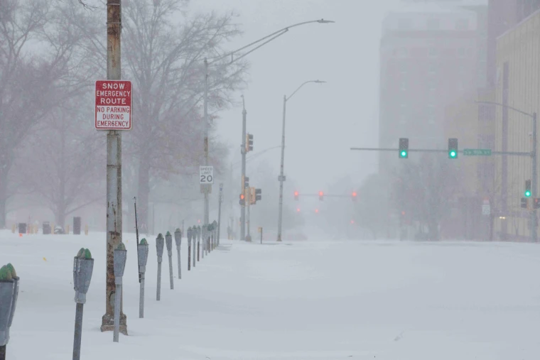
Winter Storm Blair is bringing a powerful combination of snow, ice, and blizzard conditions, along with wind gusts of up to 50 mph, to more than 60 million people in the United States. Parts of the Central and Eastern United States may experience historic snowfall, power outages, and major transport disruptions as a result of the storm. The storm is affecting states from Kansas to the mid-Atlantic as it moves eastward, having previously caused dangerous conditions in the Central Plains. The severe warning from the NOAA Weather Prediction Center reads, “For some, this could be the heaviest snowfall in over a decade.

Major consequences, such as “considerable disruptions to daily life, dangerous or impossible driving conditions, and widespread closures,” are predicted by the Winter Storm Severity Index. In many areas, the storm’s effects will last until Monday.
What to expect of Winter Storm Blair?
Kansas City, Missouri
- Alert: Blizzard warning until 12 a.m. CT Monday
- Peak Impact: Sunday afternoon
- Expected Conditions: 8 to 14 inches of snow, a glaze of ice, and wind gusts up to 45 mph.
St. Louis, Missouri
- Alert: Winter storm warning until 7 a.m. ET Monday
- Peak Impact: Sunday morning through Sunday evening
- Expected Conditions: 5 to 9 inches of snow and sleet, light sleet accumulations.
Indianapolis, Indiana
- Alert: Winter storm warning through 7 p.m. ET Monday
- Peak Impact: 1 p.m. Sunday to 7 a.m. ET Monday
- Expected Conditions: 6 to 9 inches of snow, a glaze of ice.
Louisville, Kentucky
- Alert: Winter storm warning through 7 p.m. ET Monday
- Peak Impact: Noon Sunday to 7 a.m. ET Monday, with a secondary snow burst Monday afternoon and evening
- Expected Conditions: 5 to 9 inches of snow, ice accumulations up to three-fourths of an inch.
Cincinnati, Ohio
- Alert: Winter storm warning through 12 a.m. ET Tuesday
- Peak Impact: Noon Sunday to 7 a.m. ET Monday, with a secondary snow burst Monday afternoon and evening
- Expected Conditions: 6 to 12 inches of snow, ice accumulations up to 0.1 inch.
Charleston, West Virginia
- Alert: Winter storm warning through 1 a.m. ET Tuesday
- Peak Impact: 1 p.m. Sunday to 1 p.m. Monday, with a secondary snow burst Monday afternoon and evening
- Expected Conditions: 4 to 7 inches of snow, ice accumulations between 1/2 and 1 inch.
Washington, DC
- Alert: Winter storm warning from 10 p.m. Sunday to 1 a.m. ET Tuesday
- Peak Impact: 1 a.m. to 10 p.m. Monday
- Expected Conditions: 6 to 10 inches of snow, with some suburbs potentially seeing up to a foot; trace ice accumulation.
Philadelphia, Pennsylvania
- Alert: Winter weather advisory from 1 a.m. to 10 p.m. ET Monday
- Peak Impact: 6 a.m. to 6 p.m. ET Monday
- Expected Conditions: 2 to 4 inches of snow.
The storm will move eastward over Sunday and Monday, making its way to the mid-Atlantic and Ohio River Valley. There have already been reports of dangerous weather, including thundersnow and thundersleet, in places like Kansas, Missouri, and Indiana. During peak storm hours, residents are advised to minimize needless travel, stock up on critical supplies, and prepare for power outages. For the most recent information on Winter Storm Blair, keep an eye on local weather reports.


Comments are closed, but trackbacks and pingbacks are open.