Warning: Dallas-Fort Worth Braces for a Severe Winter Storm – Are You Prepared?
The National Weather Service issued a winter storm warning for numerous North Texas counties on Wednesday morning.

Area Under Storm Warning:
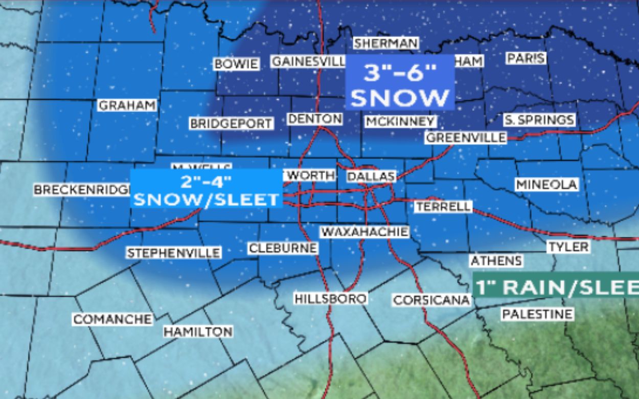
The warning will be in place from 6 a.m. Thursday until 12 p.m. Friday in Denton, Collin, Parker, Dallas, Tarrant, Rockwall, and Grayson counties. This week’s winter storm watch continues to affect surrounding counties, including Johnson, Hood, and Kaufman. A combination of snow and sleet is probable. First Alert Weather Days are also in force until Friday, owing to the coldest days of the season approaching in Dallas-Fort Worth.
How much snow is Dallas/Fort Worth expected to get?
The predicted wintry mix will come into the metroplex overnight from the west, around 4-6 a.m., moving over the I-35 corridor between 6-9 a.m. and then into the eastern counties. The strongest rains will occur from Thursday afternoon until Friday early. North Texans may expect 2 to 4 inches of sleet and snow by Thursday morning. According to the National Weather Service, individual snowfall amounts might exceed 8 inches in extreme bands. Snowfall will be heavier in counties north of Interstate 20. A powerful upper low is over the Baja Peninsula, and as of Wednesday afternoon, it has moved farther south, increasing the chance of snow accumulation in North Texas.
A clear view of Storm: Breakout of Temperature:
The weather on Wednesday will be good before the storm. Clear skies and a high of 41 degrees are anticipated. Thursday will be cold, with a high of 34 degrees and a 100% chance of precipitation. Friday’s high will be 38 degrees, with a 10% chance of precipitation. According to the most recent forecast models, the transition zone is somewhat further south, which means the metroplex may be covered in snow for longer, resulting in increased snow accumulation. Most regions, except far southern Central Texas, will receive a mix of snow and sleet Thursday evening, with all snow falling by midnight.
Tips to escape from Storm:
Driving will be hazardous when this storm passes across North Texas. Anyone who has to travel should prepare ahead, provide additional time, and drive with great caution. Ice accumulations are becoming more common, with averages of up to 1 inch; however, there is a 10% risk of accumulations nearby.25 inch. The heaviest travel consequences are forecast on Thursday and Thursday night, with conditions improving by Friday afternoon. Meteorologists with CBS News Texas First Alert say the outlook is complicated and subject to change.


Comments are closed, but trackbacks and pingbacks are open.