

Binghamton on High Alert: Snowstorm and Ice to Cripple Roads This Weekend

Binghamton residents, get ready for a messy and potentially dangerous weekend as a powerful winter storm is set to hit the region, bringing heavy snowfall, sleet, and freezing rain. Roads will become slick, visibility will drop, and travel could turn treacherous. If you have weekend plans, you may want to rethink them—this storm is shaping up to be one of the most hazardous of the season.
What to Expect from This Storm
A Winter Weather Advisory has been issued for Broome County from Saturday afternoon through early Sunday morning. The storm is expected to bring a mix of snow and ice, which will make roads dangerous and cause potential delays for travelers.
- Saturday Night: Snow will begin falling by the late afternoon and will intensify into the night. By midnight, the storm will shift, bringing a mix of sleet and freezing rain. Some areas could see snowfall totals of up to 5 inches. Winds may also pick up, further reducing visibility and making travel even more hazardous.
- Sunday Morning: Snow showers will linger through the early morning hours, with a chance of freezing rain between 7 AM and 9 AM. After that, occasional snow showers could continue throughout the day, adding another inch or less of accumulation.
How This Will Impact Travel
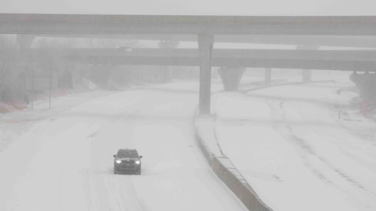
Roads will be extremely slick and hazardous. The combination of fresh snow, sleet, and ice will make highways and side streets difficult to navigate, especially in the early morning and late-night hours when temperatures are at their lowest.
Reduced visibility will make driving even more dangerous. Snowfall rates could be heavy at times, leading to near whiteout conditions.
Flight delays and cancellations possible. Binghamton Regional Airport and other nearby airports could see disruptions due to winter weather.
Who Will See the Worst Conditions?
Binghamton and surrounding areas will experience the heaviest snow totals, with 4 to 5 inches of accumulation possible.
Higher elevations in upstate New York could see slightly more snow, while lower-lying areas may get more sleet and freezing rain.
Northern Pennsylvania may also experience dangerous conditions, as the storm extends beyond New York’s borders.
How to Stay Safe During the Storm
Stay off the roads if possible. The most dangerous conditions will occur late Saturday night into early Sunday morning.
Slow down and drive with extreme caution. If you must travel, leave extra space between vehicles and use headlights even during the day.
Keep an emergency kit in your car. Pack blankets, food, water, and a flashlight in case you get stuck in icy conditions.
Stay updated on weather alerts. Follow local forecasts and tune in to emergency alerts for the latest updates on storm conditions.
Prepare for power outages. Ice buildup on power lines could lead to outages, so be sure to charge devices and have backup supplies ready.
Final Warning: This Storm Is No Joke—Be Prepared
Binghamton is no stranger to winter storms, but this one is packing a dangerous mix of snow, ice, and freezing rain that will make travel extremely difficult. If you don’t have to be on the roads, stay home and stay safe. Snowplows will be working hard, but conditions will still be treacherous, especially late Saturday and early Sunday.
As always, keep an eye on weather updates, stay prepared, and be cautious if you must travel. This storm will not be forgiving to those who aren’t ready for it.
Comments are closed, but trackbacks and pingbacks are open.