

Urgent Alert: Severe Thunderstorms and Damaging Winds Expected in Indiana!

Indiana is in the middle of a wild weather swing, going from record-breaking warmth to an impending storm system that could bring damaging winds, hail, and heavy rain by the weekend. If you’ve been enjoying the sunshine, brace yourself for a drastic change.
Spring-Like Warmth Won’t Last Long
The state has been basking in unseasonably warm temperatures, making it feel more like May than early March.
- Indianapolis hit 73°F (23°C) today, coming close to breaking a 1990 record of 74°F.
- Fort Wayne saw highs near 62°F (17°C), with clear skies and a light breeze.
- Evansville enjoyed the warmest conditions, reaching 77°F (25°C) under partly sunny skies.
For those who thought winter was over, think again. A major pattern shift is on the way, bringing a sharp cooldown and severe weather risks as early as Thursday night into Friday.
Cold Front Brings a Temperature Drop & Rain Showers
By Thursday, March 13, a strong cold front will start moving in, dropping temperatures across the state.
- Indianapolis will cool down to 64°F (18°C), with increasing clouds and the chance of an afternoon shower.
- Fort Wayne will reach 63°F (17°C), with mostly sunny skies turning cloudy by evening.
- Evansville will fall to 70°F (21°C), with scattered showers and possibly a thunderstorm developing late.
Though Thursday will still be mild compared to average March temperatures, this shift sets the stage for a bigger storm system expected on Friday and Saturday.
Severe Storms Possible Friday Night into Saturday
By Friday, March 14, temperatures will surge again, creating unstable conditions that could trigger severe thunderstorms across the state.
- Indianapolis will warm up to 76°F (24°C), with gusty winds developing in the afternoon.
- Fort Wayne will reach 72°F (22°C), with partly sunny skies giving way to evening storm chances.
- Evansville could hit 78°F (26°C), but forecasters warn of strong storms moving in after dark.
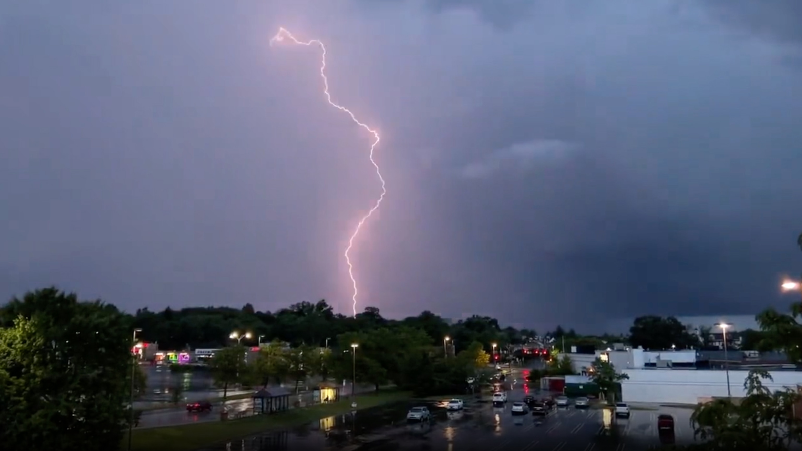
Storm Threats: What Could Happen?
- Damaging wind gusts over 60 mph
- Heavy rain leading to flash flooding in low-lying areas
- Possible hail and isolated tornadoes
What You Should Do to Stay Safe
- Secure outdoor items – Winds could be strong enough to blow around patio furniture and trash bins.
- Prepare for power outages – Have flashlights, extra batteries, and an emergency kit ready.
- Stay updated on the forecast – This storm system could intensify quickly, so be alert for weather warnings.
- Avoid flooded roads – Even a few inches of water can be dangerous when driving.
Looking Ahead: Calm After the Storm?
By Sunday, March 16, the severe weather should move out, but temperatures will dive, falling back into the upper 40s and low 50s. Cooler air will dominate into next week, bringing a return to typical March weather. After a week of sunshine, storms, and a major cooldown, Indiana’s weather is proving once again that March is anything but predictable.
Comments are closed, but trackbacks and pingbacks are open.