

Dangerous Storm Warning: Oregon Hit by Massive Snowfall, Fierce Winds, and Rising Floodwaters!
 By Shiwangi Arya
Share with new partner:
By Shiwangi Arya
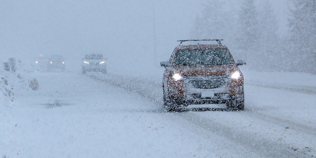
Share with new partner: Oregon residents need to prepare now, as a powerful winter storm is set to wreak havoc across the state this weekend. The National Weather Service (NWS) has issued Winter Storm Warnings, High Wind Advisories, and Flood Watches as conditions deteriorate. Massive snowfall, hurricane-force winds, and dangerous flooding could impact travel, power grids, and daily life, making this one of the most dangerous weather events of the season. The storm is expected to unleash feet of snow in the mountains, bring 75 mph wind gusts to coastal areas, and dump heavy rain, increasing the risk of flash floods in low-lying regions. Officials are urging residents to take immediate precautions before the worst conditions arrive.
Heavy Snow Will Bury Parts of Oregon
A Winter Storm Warning is in effect for the Cascade Mountains, where snowfall totals of 1 to 3 feet are expected above 4,000 feet by the time the storm moves out. Blowing snow and icy roads will make travel dangerous, if not impossible, through major mountain passes, including Snoqualmie Pass and Willamette Pass. The storm’s strong winds, paired with heavy snow, could also lead to downed trees and power lines, increasing the risk of widespread power outages in rural areas. Forecasters warn that those traveling through higher elevations should prepare for whiteout conditions, dangerously slick roads, and road closures. If you live in higher elevations, ensure you have emergency supplies, including extra food, water, and alternative heat sources, in case of a prolonged power outage.
Coastal Areas Face Hurricane-Force Winds
While the mountains will be dealing with feet of snow, coastal and inland areas will face dangerous winds capable of causing widespread damage.
The NWS has issued a High Wind Warning, stating that wind gusts along the Oregon coast could reach 75 mph or higher. Further inland, wind gusts up to 60 mph are expected in Eugene, Portland, and surrounding areas. These powerful winds could:
- Knock out power for thousands of residents
- Topple trees and power lines
- Make travel extremely hazardous, especially for high-profile vehicles
If you live in a wind-prone area, secure loose outdoor items, charge your devices, and prepare for potential power outages.
Flooding Concerns Grow as Heavy Rain Moves In
In addition to snow and wind, heavy rainfall will drench parts of western Oregon, creating serious flooding concerns in low-lying areas. Forecasters say the storm could dump up to 3 inches of rain in just 24 hours, causing:
- Urban flooding in cities like Portland and Eugene
- Rising rivers and streams, with possible flash floods in low-lying areas
- Mudslides and landslides in burn scar regions
If you live in a flood-prone area, prepare now. Move valuables to higher ground, clear storm drains, and never drive through flooded roadways—it only takes a foot of water to sweep a car away.
How to Stay Safe During Oregon’s Extreme Weather
With multiple severe threats approaching, it’s crucial to take precautions now before conditions worsen.
- Check Weather Alerts Frequently: The storm will develop rapidly, so keep an eye on NWS warnings and updates.
- Avoid Mountain Travel: Snow-covered roads and high winds will make travel extremely dangerous—postpone trips if possible.
- Prepare for Power Outages: Charge devices, stock up on batteries, and have a backup heat source ready in case of prolonged outages.
- Stay Away From Flooded Areas: If you live in a flood-prone area, be prepared to evacuate if conditions worsen.
When Will the Storm Hit?
The worst conditions are expected to hit late Saturday into Sunday, with:
- Heavy snowfall continuing through Sunday night in the Cascades
- Winds peaking Saturday night into Sunday morning
- Flash flood risks are highest Sunday afternoon
The Bottom Line
Oregon is about to experience one of the most dangerous weather events of the season. With blizzard conditions in the mountains, extreme winds along the coast, and the potential for major flooding in cities and low-lying areas, this storm demands immediate attention. If you haven’t prepared yet, now is the time. Secure outdoor objects, prepare for power outages, and avoid travel if possible. This storm is not to be underestimated. Stay informed, stay prepared, and most importantly—stay safe.
Comments are closed, but trackbacks and pingbacks are open.