

Is Your Family Safe? High Winds, Snow, and Fire Risks Threaten North Dakota
 By Shiwangi Arya
Share with new partner:
By Shiwangi Arya
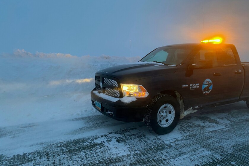
Share with new partner: North Dakota is in for a wild and dangerous weekend as meteorologists warn of a trifecta of extreme weather threats across the state. Residents should prepare for hurricane-force winds, sudden bursts of snow, and an elevated wildfire risk that could impact travel, power lines, and public safety. The National Weather Service (NWS) has issued high wind warnings, winter weather advisories, and fire weather alerts, cautioning that conditions will rapidly deteriorate throughout the state. This isn’t just another storm—this is a serious threat that could disrupt daily life for thousands of people.
Damaging Winds Could Knock Out Power and Make Travel Dangerous
The biggest immediate concern is extreme winds sweeping across eastern and southeastern North Dakota, where gusts are expected to reach up to 60 mph. These powerful winds could cause:
- Widespread power outages, as strong gusts snap tree branches and bring down power lines.
- Dangerous travel conditions, especially for high-profile vehicles that could be pushed off the road.
- Flying debris hazards, with unsecured outdoor furniture, trash cans, and other loose objects potentially turning into projectiles.
Authorities are urging residents to stay indoors if possible and secure outdoor belongings before the worst winds hit. If you must travel, be prepared for strong gusts that could make driving difficult, especially in open areas.
Blizzard Conditions Expected With Sudden Snow Bursts
Alongside the howling winds, parts of eastern North Dakota, including Grand Forks and Fargo, will see blowing snow and possible whiteout conditions. Forecasters say 2 to 4 inches of snow could fall in some areas, but with wind gusts up to 65 mph, even a small amount of snow could create blizzard-like conditions.
This means:
- Extremely low visibility, making driving hazardous.
- Snow-covered roads that will be slick and dangerous, especially on bridges and overpasses.
- Risk of stranded motorists, as travel could quickly become impossible in some areas.
If you don’t have to be on the road, stay home. If you must drive, carry an emergency kit with blankets, food, water, and a flashlight in case you get stranded.
Wildfire Danger Looms for Western North Dakota
As eastern North Dakota deals with blizzards, western parts of the state face an entirely different danger—wildfires. With strong winds, dry air, and drought conditions, the NWS has issued Red Flag Warnings, meaning any small fire could quickly turn into a dangerous wildfire.
Fire officials are warning:
- Avoid all outdoor burning, including bonfires and controlled burns.
- Properly dispose of cigarettes and avoid parking on dry grass, as a spark could ignite a fire.
- Be prepared for evacuation notices if a wildfire starts in your area.
How to Stay Safe in This Extreme Weather Event
With multiple threats unfolding at the same time, it’s critical for North Dakotans to take precautions now to protect themselves and their families.
- Stay Updated: Keep a close eye on local weather alerts and emergency warnings.
- Prepare for Power Outages: Charge your phone, gather extra batteries, and have flashlights ready.
- Secure Outdoor Items: Strong winds will blow away anything that isn’t tied down—bring in trash cans, patio furniture, and anything else that could become airborne.
- Avoid Unnecessary Travel: If snow and winds are making conditions unsafe, stay off the roads.
- Be Fire Smart: Avoid any activity that could start a fire, and report any smoke or flames to authorities immediately.
When Will the Worst Hit North Dakota?
The most dangerous conditions are expected throughout Saturday and into early Sunday, with winds peaking in the afternoon and evening. Blizzard-like conditions will develop as snow moves into the eastern half of the state, while fire risks will remain high in the west throughout the weekend. North Dakota is facing one of its most extreme weather events in recent memory. With violent winds, dangerous snow, and the looming threat of wildfires, this is not a normal March storm. If you haven’t taken precautions yet, do it now. Stay indoors if possible, avoid travel, and be prepared for power outages. This storm will impact different areas in different ways, but one thing is certain—this is not to be taken lightly. Stay alert, stay prepared, and most importantly, stay safe.
Comments are closed, but trackbacks and pingbacks are open.