

Prepare for Weather Chaos: Snow, Freezing Temps, and a 35° Drop in Montreal!
 By Shiwangi Arya
Share with new partner:
By Shiwangi Arya
Share with new partner: Montrealers, brace yourselves! The next few days will bring a wild mix of weather that could catch many off guard. One moment, it will feel like spring is here, and the next, winter will come roaring back with freezing temperatures and snowfall. If you’ve been enjoying the mild weather, don’t get too comfortable—things are about to change drastically.
A Beautiful Saturday… But Don’t Get Used to It
Today, Saturday, March 22, offers a brief taste of spring, with temperatures climbing to a pleasant 51°F (10°C). The morning will be mostly cloudy, and by the afternoon, light rain showers will move in. It’s a perfect day to get outside before the real trouble starts. But here’s the catch: by nightfall, temperatures will plummet to a bone-chilling 15°F (-10°C). That’s a drop of nearly 35 degrees in just a few hours! Roads could become icy, and the sudden shift in temperatures will make it feel like winter has returned overnight.
Sunday: Cold and Clear, But Don’t Let Your Guard Down
If you’re hoping for better weather on Sunday, think again. While the sun will be shining, it will do little to warm up the city. The high will barely reach 31°F (-1°C), and the night will bring another deep freeze at 22°F (-5°C). It may look nice outside, but you’ll need your warmest winter coat if you’re heading out.
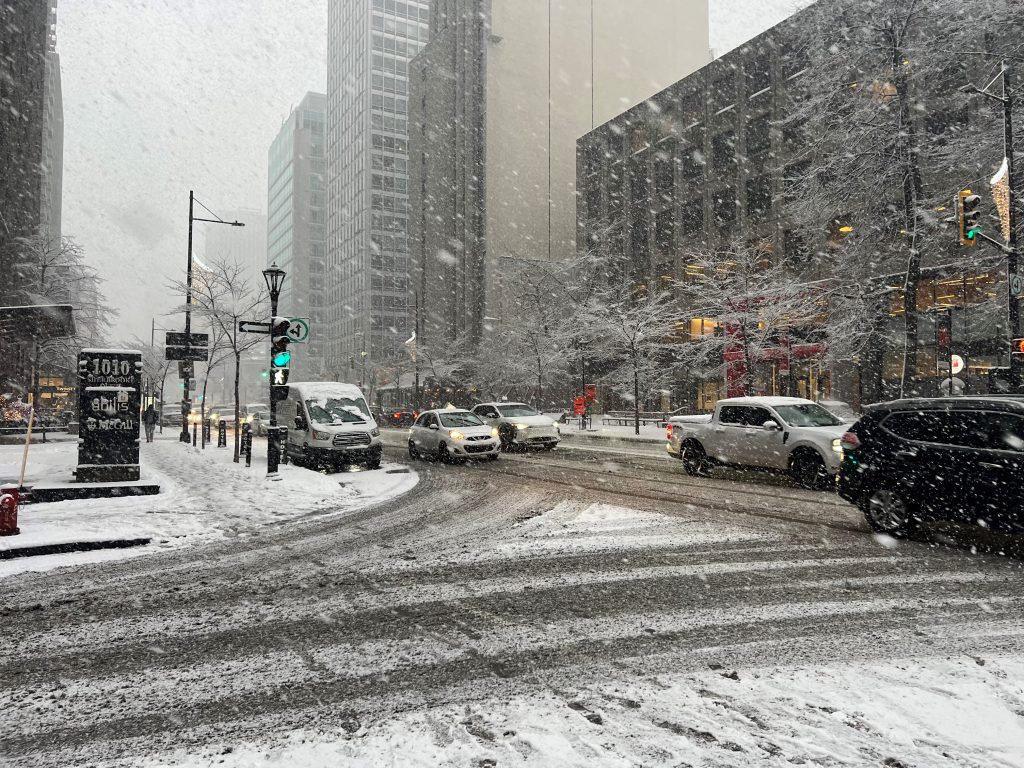
Monday: Snowstorm Incoming—Prepare for Slippery Roads!
Monday, March 24, will mark another major shift as snow moves into the area. Expect 3 to 6 centimeters of accumulation, making roads slippery and travel conditions hazardous. The high will hover around 41°F (5°C), but with snow and moisture in the air, it will feel much colder. Drivers should be prepared for reduced visibility and icy spots on the roads, especially in the morning and evening hours. Plan extra time for your commute and use caution while driving.
Tuesday and Wednesday: More Cold and a Chance of Rain or Snow
Tuesday will bring a mix of rain and snow showers, keeping conditions wet and messy throughout the day. The high will reach 39°F (4°C), with overnight lows near 30°F (-1°C). By Wednesday, things start to settle slightly, with partly cloudy skies and highs around 36°F (2°C). However, temperatures will remain chilly, dropping to 25°F (-4°C) at night.
Late-Week Warm-Up—A Small Glimmer of Hope
Thursday will bring a welcome return to sunshine, and temperatures will begin to rise again, reaching 42°F (6°C). The overnight low will stay near freezing at 29°F (-2°C). By Friday, the weather takes another turn, with clouds rolling in and afternoon rain possible. The high will be 38°F (3°C), with a nighttime low of 26°F (-3°C).
How to Stay Safe and Prepared
-
Prepare for a Sudden Freeze – A massive temperature drop is coming, so make sure to dress in warm layers to avoid the shock of freezing air.
-
Watch for Icy Roads – The shift from rain to snow means black ice could form overnight, making walking and driving hazardous.
-
Check Your Winter Gear – Just when you thought you could pack up your winter coat, you’ll need it again! Hats, gloves, and boots will be necessary this week.
-
Plan Extra Time for Travel – Monday’s snowfall and Tuesday’s rain/snow mix could create messy road conditions, so allow for delays.
-
Stay Updated on Forecasts – With weather changing rapidly, keep an eye on local updates to avoid getting caught in a sudden storm.
Montreal is in for a chaotic week of temperature swings, snow, and freezing nights. Just when it seems like spring is here, winter will come back with a vengeance. Stay warm, stay safe, and be ready for anything!
Comments are closed, but trackbacks and pingbacks are open.