

Massive Storm Heading for Minnesota: What You Need to Know About Flash Flooding and Power Outages!

A dangerous storm system is expected to sweep across Minnesota today, bringing flash flooding, strong winds, and the possibility of hail. The National Weather Service has issued Severe Thunderstorm Warnings and Flash Flood Watches for cities like Minneapolis, St. Paul, Duluth, and Rochester. Residents should be prepared for rapidly changing weather, with the potential for damaging winds, flash floods, and hail that could cause significant damage.
Severe Storms Expected Across Minnesota
The storm will hit western Minnesota by the afternoon and quickly spread eastward throughout the day. Minneapolis and St. Paul will begin to feel the effects by late afternoon, with heavy rain and strong winds gusting up to 60 mph. Duluth and Rochester will experience similar conditions in the evening, with the potential for hail of up to 1 inch in diameter. The entire state is at risk for flash flooding, damaging winds, and travel disruptions as the storm moves across the region.
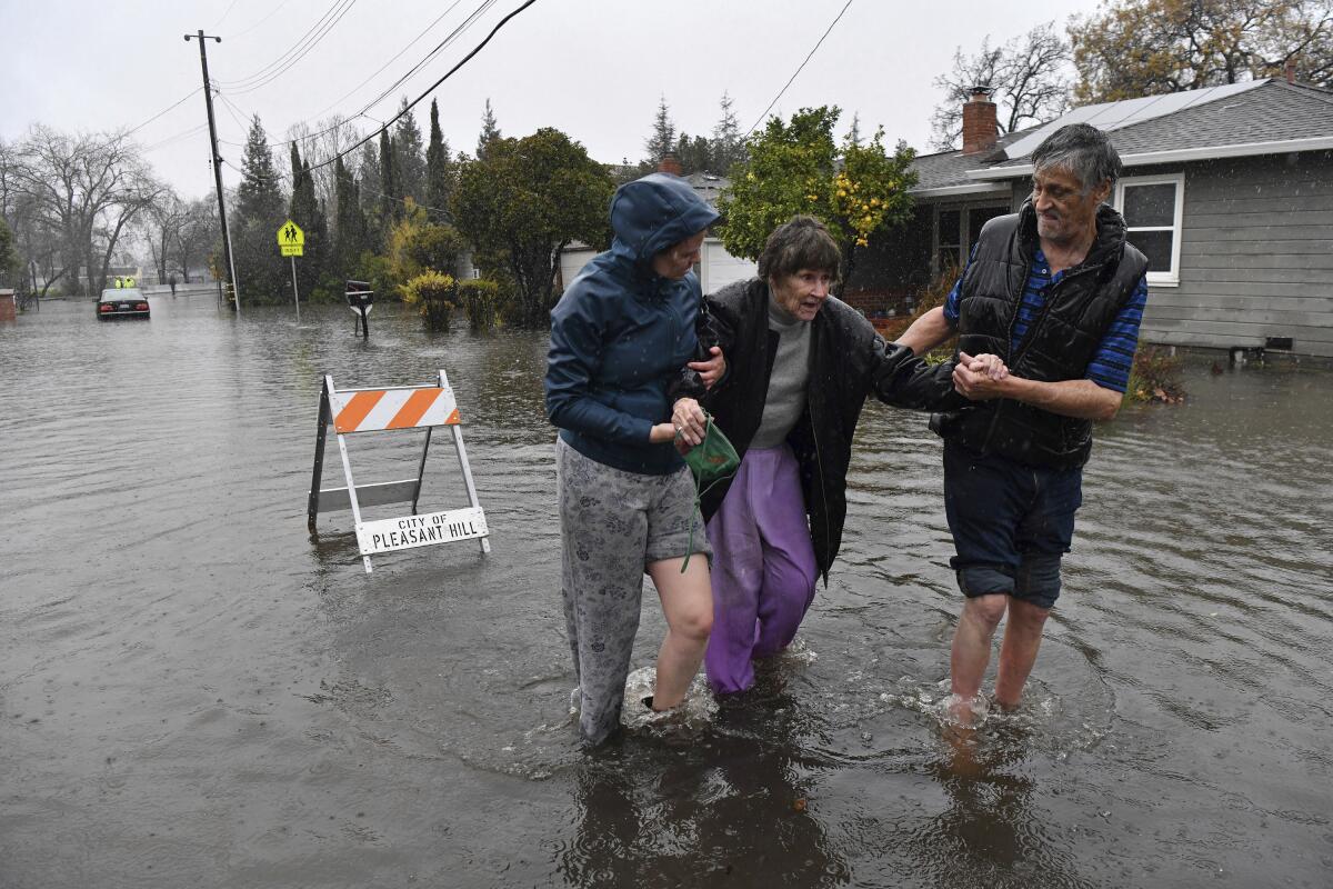
Flash Flooding and Road Hazards
Flash flooding is a major concern, especially in low-lying areas, near rivers, and around poor drainage systems. Minneapolis, St. Paul, Rochester, and Duluth are all at risk for localized flooding due to the intense rainfall expected with the storm. Major highways such as Interstate 94, Interstate 35, and U.S. Highway 52 could be impacted by floodwaters, making driving conditions hazardous. If you encounter a flooded road, turn around and find an alternate route. Streets in Minneapolis and St. Paul could quickly become flooded, so residents should stay alert and avoid traveling unless necessary.
Damaging Winds and Hail Likely
In addition to the heavy rain, the storm will bring damaging winds of up to 60 mph. The strong winds will create the potential for downed trees, power outages, and damage to homes and vehicles. Minneapolis, St. Paul, and Rochester are expected to be the most affected by the winds, which could also bring flying debris and cause damage to outdoor structures. The hail expected with this storm could also cause significant harm, especially to cars, crops, and windows. Hailstones as large as 1 inch are possible, so it’s important to seek shelter immediately if caught outside.
Power Outages and Travel Disruptions
Power outages are likely due to the high winds and the potential for downed trees and power lines. Minneapolis, St. Paul, and Rochester are at risk for widespread outages, particularly in suburban and rural areas. Travel disruptions are expected as flooded roads and fallen trees could block highways and other critical routes. Residents should avoid traveling on I-94, I-35, and U.S. 52 if conditions worsen. Local transit services in Minneapolis and St. Paul may also face delays, so commuters should plan accordingly.
Safety Tips for Severe Weather
To protect yourself and your property, here are some essential tips for staying safe:
-
Stay Indoors: Avoid going outside during the storm, especially when winds and hail are most intense.
-
Monitor Weather Alerts: Stay informed about the latest warnings and advisories from the National Weather Service and local authorities.
-
Avoid Flooded Roads: If you come across flooded streets, turn around and do not attempt to drive through water.
-
Prepare for Power Outages: Ensure you have flashlights, batteries, and emergency supplies on hand.
-
Secure Outdoor Items: Bring in or secure outdoor furniture and anything that could be tossed by the wind.
Minnesota is bracing for a severe storm system that will bring flash flooding, strong winds, and hail to much of the state. Minneapolis, St. Paul, Rochester, and Duluth are all at risk of damaging weather conditions. Flash floods, power outages, and wind damage could cause disruptions throughout the region. Residents should take precautions to stay safe by avoiding flooded areas, staying informed, and securing their homes. With the storm approaching, it’s important to be prepared and act quickly to protect yourself and your property.
Comments are closed, but trackbacks and pingbacks are open.