

North Texas in the Crosshairs: Tornadoes and Destructive Storms Expected

A powerful line of severe storms is sweeping across North Texas, prompting a Tornado Watch for much of the region through 10:00 p.m. tonight. Forecasters warn that conditions are ripe for dangerous tornadoes, massive hail, and destructive winds, urging residents to take immediate precautions.
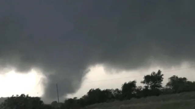
The National Weather Service has placed several counties under the alert, including Dallas, Tarrant, Denton, Collin, Johnson, Ellis, Grayson, Cooke, and Rockwall. Officials say the atmosphere is extremely unstable, with the potential for supercell storms to form quickly and produce long-track tornadoes, which can be especially damaging.
“We’re watching for tornadoes that could develop rapidly with little warning,” said meteorologist Alex Garcia. “These storms are capable of producing hail larger than golf balls and wind gusts over 70 miles per hour.”
By mid-afternoon, temperatures across the Dallas-Fort Worth metroplex hovered in the mid-70s, paired with high humidity—ideal fuel for explosive storm development. Thunderstorm activity is expected to increase through the evening, with the most severe weather likely between 4 p.m. and 9 p.m.
Emergency officials are asking residents to have a plan in place, keep weather radios charged and ready, and stay indoors once warnings are issued. Those living in mobile homes or vulnerable structures are strongly encouraged to seek sturdier shelter.
Local school districts and businesses have begun issuing early dismissals and closing outdoor activities due to the risk of fast-developing storms. Utility crews are also on standby as power outages are possible with high wind gusts and potential lightning strikes.
For real-time updates and live radar coverage, residents can tune in to local news or follow the National Weather Service – Fort Worth on social media platforms.
Comments are closed, but trackbacks and pingbacks are open.