

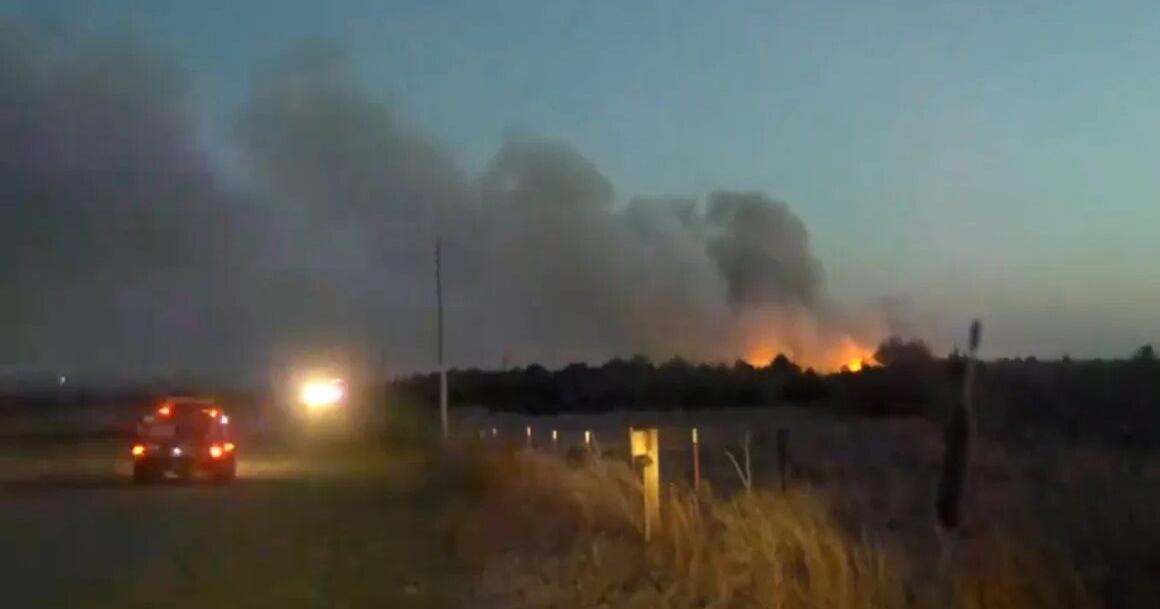
Jackson County Under Red Flag Warning: High Winds, Dry Air Fueling Wildfire Threats!

Jackson County is facing an unusually warm day, with temperatures climbing to 79°F (26°C), creating prime conditions for a high fire risk. The National Weather Service has issued a Red Flag Warning for the area, signaling critical fire weather due to gusty winds, low humidity, and record-high temperatures. This warning, which remains in effect until 8:00 PM CDT today, has residents on high alert as fire hazards remain high throughout the day.
Warm Temperatures and Gusty Winds Fuel Fire Danger
As of 11:00 AM CDT, Kansas City saw temperatures of 66°F (19°C) under bright, sunny skies. Winds are already picking up, with sustained speeds of 15 to 25 mph and gusts potentially reaching over 40 mph. Combined with humidity levels as low as 20%, these conditions are a perfect recipe for wildfire danger. For the rest of the day, residents can expect temperatures to rise further, reaching a high of 79°F (26°C). The evening will bring some relief as temperatures dip to a low of 47°F (8°C), but the risk of fires continues as strong winds and low humidity persist.
What’s a Red Flag Warning?
A Red Flag Warning indicates that fire conditions are ideal for the rapid spread of fires. The combination of high winds, dry air, and warm temperatures means that any fire that ignites could spread quickly, posing serious threats to safety and property. The National Weather Service urges everyone to avoid outdoor burning and to exercise extreme caution when participating in activities like grilling or using power equipment that could spark fires.
What Residents Should Do:
- Avoid Outdoor Burning: Do not burn trash, use fire pits, or engage in any outdoor activity that could create sparks.
- Be Cautious with Equipment: If using outdoor equipment, be sure to clean it properly and avoid dry grass areas to prevent igniting flames.
- Stay Alert: Stay informed about fire conditions and remain prepared in case of emergencies.
- Have an Emergency Plan: Know what to do and where to go if a fire breaks out near you.
What’s Next for Jackson County’s Weather?
The extreme warmth won’t last long, as cooler temperatures are expected to settle in after today. Over the next few days, temperatures will decrease, with highs ranging from the mid-50s to low 60s°F (12-16°C), and lows dipping to the mid-30s to low 40s°F (2-6°C). The winds will continue to be a factor, but there’s a chance of rain and even snow in the coming days, which could provide some relief from fire dangers. However, for now, residents are urged to remain cautious and stay updated on the weather to avoid fire-related risks. Even though the Red Flag Warning expires later today, the dangers of wildfires won’t be completely over until weather conditions improve significantly.
Why This Is Important
While spring typically brings milder weather, this year’s unseasonably high temperatures and dry conditions have created ideal conditions for fires to spread quickly. Jackson County residents need to be aware of the weather, especially with unpredictable spring conditions and the possibility of stronger winds or rain in the future.
Comments are closed, but trackbacks and pingbacks are open.