

Long Island on High Alert: Flash Floods, High Winds, and Power Outages Predicted Tonight!
 By Shiwangi Arya
Share with new partner:
By Shiwangi Arya
Share with new partner: Get ready, Long Island. A powerful storm system is making its way to the region, and it’s expected to hit tonight with a vengeance. From heavy rainfall to gusty winds and the real threat of flash flooding, residents are being urged to prepare for what could be a very rough night ahead.
What to Expect Tonight:
The storm will roll into Long Island this evening, with the first drops of rain beginning by 9:00 PM. Meteorologists predict that the heaviest rain will fall between 9:00 PM and midnight, with some areas expecting 1-2 inches of rain. The intense downpours could lead to localized flooding, especially in areas that are prone to flooding or have poor drainage systems. But it’s not just the rain that should have residents concerned—strong winds are also a major factor. Wind gusts could reach up to 50 mph, which is strong enough to bring down trees, power lines, and cause power outages across the region. If you have outdoor furniture or other unsecured items, now is the time to bring them inside.
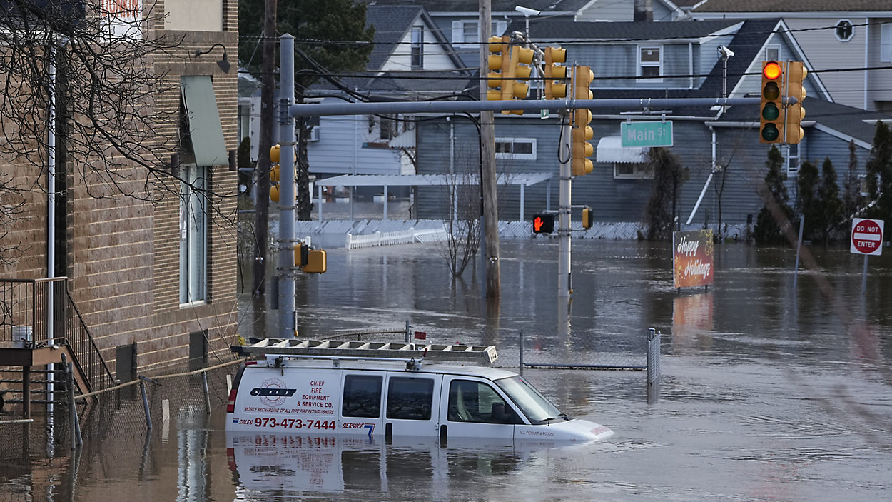
Flash Flood Risk:
Long Island is under a Flash Flood Warning tonight, with areas of Nassau and Suffolk Counties at risk. Flooding could occur rapidly, with roads becoming impassable in a matter of minutes. Low-lying areas and places near rivers or streams are particularly vulnerable. If you’re in one of these areas, move to higher ground and avoid driving through flooded streets. Even a few inches of water can be dangerous and cause accidents or strand vehicles.
Power Outages and Storm Safety:
With winds gusting up to 50 mph, the possibility of power outages is high. Residents are urged to charge devices ahead of time, and make sure they have flashlights and extra batteries ready. It’s also a good idea to stock up on essentials like bottled water and non-perishable food, just in case the storm disrupts power for an extended period. Stay inside once the storm begins, and avoid any unnecessary travel. The weather will be treacherous, and driving through flooded or debris-filled streets could put you in harm’s way.
Preparing for the Storm:
-
Secure loose outdoor objects: High winds can turn anything from garbage cans to patio furniture into dangerous projectiles. Bring anything that isn’t firmly anchored inside.
-
Have an emergency kit ready: Make sure you have a flashlight, extra batteries, bottled water, snacks, and any medications you may need in case of a power outage or an extended storm.
-
Avoid flood-prone areas: Don’t attempt to drive through flooded roads, and avoid walking through standing water. It’s easy to underestimate how dangerous floodwaters can be.
What’s Next for Long Island?
The storm will pass by early tomorrow, Tuesday, April 1, but the weather will remain cooler and breezier for the rest of the day. The high temperature will only reach 47°F (8°C), with winds making it feel even colder. Tomorrow’s chilly weather will be followed by more variable cloudiness on Wednesday, with temperatures rising slightly to 48°F (9°C).
Stay Safe, Long Island:
This storm is no small matter, and residents of Long Island should take immediate action to prepare. Flash flooding, damaging winds, and power outages are all threats that could disrupt your night and even affect your safety. Secure your home, stay informed, and take precautions now before the storm arrives. With heavy rain, high winds, and the possibility of significant flooding, this is a storm you don’t want to take lightly.
Comments are closed, but trackbacks and pingbacks are open.