

Severe Weather Hits Washington, D.C.: Flash Flooding, High Winds, and Widespread Power Outages!
 By Shiwangi Arya
Share with new partner:
By Shiwangi Arya
Share with new partner: A powerful storm has struck Washington, D.C. with a vengeance, and the capital city is bracing for more damage as flash flooding, downed trees, and widespread power outages continue to wreak havoc. The storm, which started late Monday afternoon, is expected to worsen before gradually improving tomorrow.
What’s Happening Right Now:
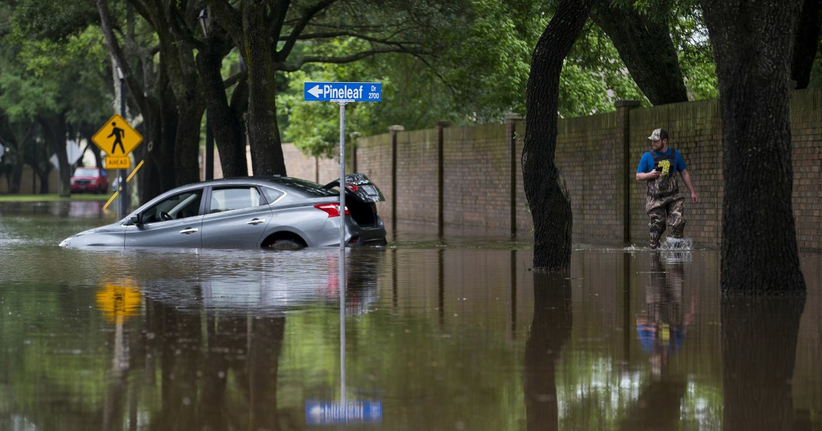
As of this evening, the storm has caused flash flooding across parts of the city, particularly in low-lying areas and neighborhoods near rivers. Several streets are underwater, and emergency responders are advising residents to avoid travel unless necessary. Wind gusts are reaching up to 50 mph, and these strong winds are toppling trees, some of which have fallen onto roads, cars, and power lines. The heavy rains started around 3:00 PM, and more rain is expected to continue falling throughout the night, with conditions worsening until about 9:00 PM. Flash flood warnings remain in effect across D.C., especially in Anacostia, Capitol Hill, and Georgetown, where flooding has already caused major disruptions.
Power Outages and Damage:
Thousands of Washingtonians are without power tonight as strong winds and heavy rain knock out power lines. Crews are working around the clock to restore electricity, but experts warn it could take hours before outages are fully resolved. If you’re experiencing a power outage, make sure you have an emergency kit with flashlights, extra batteries, and bottled water, as it’s unclear when electricity will be restored in affected areas. Residents are also urged to avoid going outside unless necessary, as falling tree limbs and debris present a major hazard. Cars have been trapped on flooded roads, and sidewalks are becoming difficult to navigate in some areas.
Flash Flood Warning in Effect:
The Flash Flood Warning issued by the National Weather Service remains in effect throughout the evening. Several parts of D.C. have seen over an inch of rain in a short amount of time, and more rain is expected. The city’s drainage systems are overwhelmed, and roads are expected to remain flooded for several hours.
What You Need to Do Now:
-
Stay Indoors: As the storm continues to intensify, everyone must remain indoors and off the roads. Flash floods are extremely dangerous and can occur quickly.
-
Don’t Drive Through Floodwaters: Never attempt to drive through flooded streets. Even a few inches of water can make driving dangerous, and vehicles can quickly become stranded.
-
Prepare for Power Outages: If you haven’t already, charge your phones and electronic devices. Make sure you have candles, flashlights, and other backup lighting sources ready.
What’s Next for Washington, D.C.?
As the storm moves out tonight, conditions will improve tomorrow morning. By Tuesday, April 1, the weather should clear up, and the rain will stop by mid-morning. Temperatures will be cooler, and though winds will remain breezy, the risk of flash floods should subside by the afternoon. The rest of the week will feature mostly clear skies and cooler temperatures. On Wednesday, April 2, expect a high of 63°F (17°C), and Thursday will bring even warmer conditions as temperatures could reach 81°F (27°C). However, be aware that another round of storms is possible later in the week.
Stay Safe, Washington, D.C.
This storm is not over yet, and Washington residents need to remain vigilant. With flash flooding, high winds, and power outages affecting much of the city, it’s essential to follow safety precautions and stay informed. Stay indoors, avoid travel, and continue monitoring local weather updates to ensure you are prepared for any further developments. Stay safe, D.C.
Comments are closed, but trackbacks and pingbacks are open.